This term designates a part of central Italy located between the middle and lower Tiber and the Tyrrhenian Sea, roughly corresponding to today’s northern Lazio, with the three mountain groups of the Sabatini, Cimini, and Vulsini. The name derives from the fact that the territory was in ancient times an Etruscan area, while in the Middle Ages it early on became part of the Papal States (the heritage of St. Peter). Tuscia Romana exhibits a certain physical unity precisely thanks to these three mountain groups, which are ancient, extinct volcanic formations with numerous craters now partly occupied by lakes. They generally provide soils favorable to cultivation (especially vineyards, as well as olives and wheat), except where there are extensive outcrops of hard lava, which correspond to areas of sparse pastures or scrub. The forest, which once densely and continuously covered the higher regions, has disappeared—except in the Cimini. The coast is rugged and sparsely populated: the only center of maritime life is Civitavecchia, a port that is almost entirely artificial.
The numerous watercourses that, from the highest parts of the three groups, flow either into the Tiber (Vezza, Treia, Galera) or directly into the Tyrrhenian (Arrone, Mignone, Marta) have carved out, in the volcanic plateaus, valleys that are sometimes very deep with steep walls. The points where two valleys converge—thereby limiting on several sides the edges of the intervening plateau, which descends with steep slopes along the two watercourses—are favored sites for settlements for defensive reasons; indeed, this special configuration, exemplified by the ancient Veio and the centers of Sutri, Nepi, Civita Castellana, Calcata, etc., constitutes a characteristic feature of Tuscia Romana.
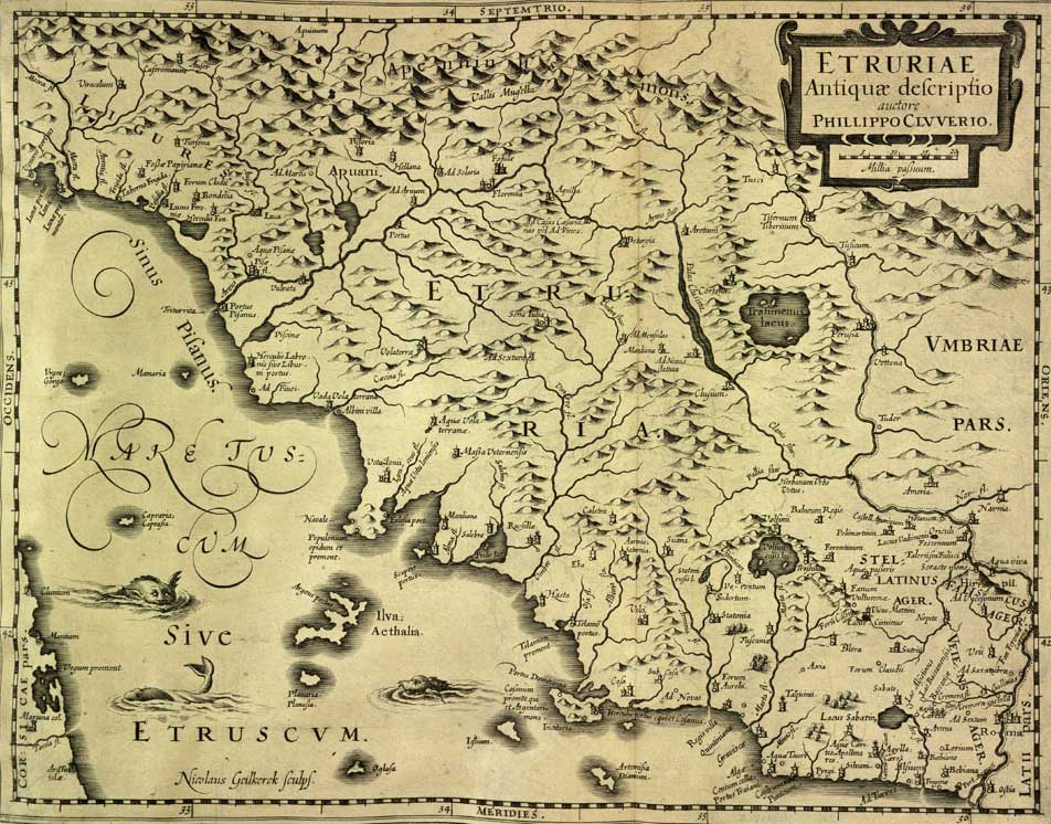
The intricate network of these valleys, both major and minor, all somewhat recessed, hinders transportation: among the ancient roads that connected Rome with Tuscany, if one sets aside the coastal route (the Aurelia) and that along the right bank of the Tiber (the Flaminia), there was essentially only one main route running approximately along the watershed between the Tiber and the Tyrrhenian Sea, namely the Cassia. Growing in importance towards the end of the classical era and during the Middle Ages, it spurred the development of several centers situated along its path or in close proximity, such as Sutri, Viterbo, Montefiascone, and Acquapendente (see the individual entries). Not far from this route runs the Rome-Viterbo-Montefiascone railway. Direct connections from the Tyrrhenian to the middle Tiber valley are also challenging; these are now served by the Civitavecchia-Orte railway and four bus lines.
The capital of Tuscia Romana is Viterbo (with over 38,000 inhabitants), followed closely by Civitavecchia (36,000). The other centers are today all of secondary importance. The rural population is generally very sparse, except in the Viterbo plain and its adjacent regions, and in some areas at the foothills of the Cimini.
Roman and Lombard Tuscia – The name of the ancient imperial-era province persisted even during the Byzantine and Lombard periods, when it was transformed into a duchy with its center in Lucca, and roughly comprised not only what is now Tuscany proper but also the territory of the Maremma. From the beginning of the 8th century onward—specifically with the first donations made by the Lombards to the popes (in Sutri, Bieda) and with the initial establishment of the Church's territorial sovereignty—the Patrimonium of St. Peter in Tuscia detached itself from the original body of Byzantine and Lombard Tuscia, later also known as Roman Tuscia.
Its shores are divided among the municipalities of Rome, Anguillara Sabazia, and Campagnano di Roma. It covers an area of 2.44 square kilometers, is located 205 meters above sea level, and has a maximum depth of approximately 60 meters. The lake has several small inlets, mostly seasonal, but no outlet. The basin has a length of 2.015 km, a width of 1.545 km, and a shoreline of about 6 km.
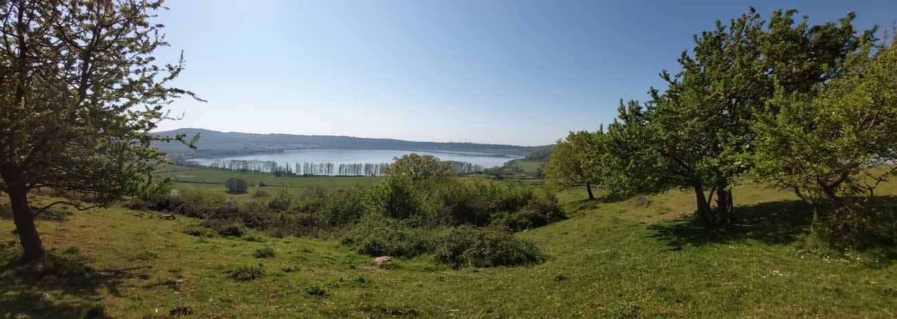
Prominent multifunctional agricultural operations, mostly organic, overlook the lake, while no urban center does—except for a few isolated farmhouses and three agriturismi. No road has been built along the perimeter circuit, allowing the area to remain virtually pristine. This characteristic was exploited for the setting of the Blue Fairy’s house in Luigi Comencini’s television adaptation The Adventures of Pinocchio, one of the first films shot on location, with many others following over the years.
Although the lake is very close to the basin of Lake Bracciano, it is not connected to it.
Martignano Lake is situated within the protected area of the Bracciano-Martignano Lake Complex Regional Natural Park, and thus it cannot be reached by private vehicles except through the entrances of the agriturismi present. However, it is possible to park your car in an unattended public parking lot in Anguillara Sabazia and then take a shuttle that connects the parking area with the lake.
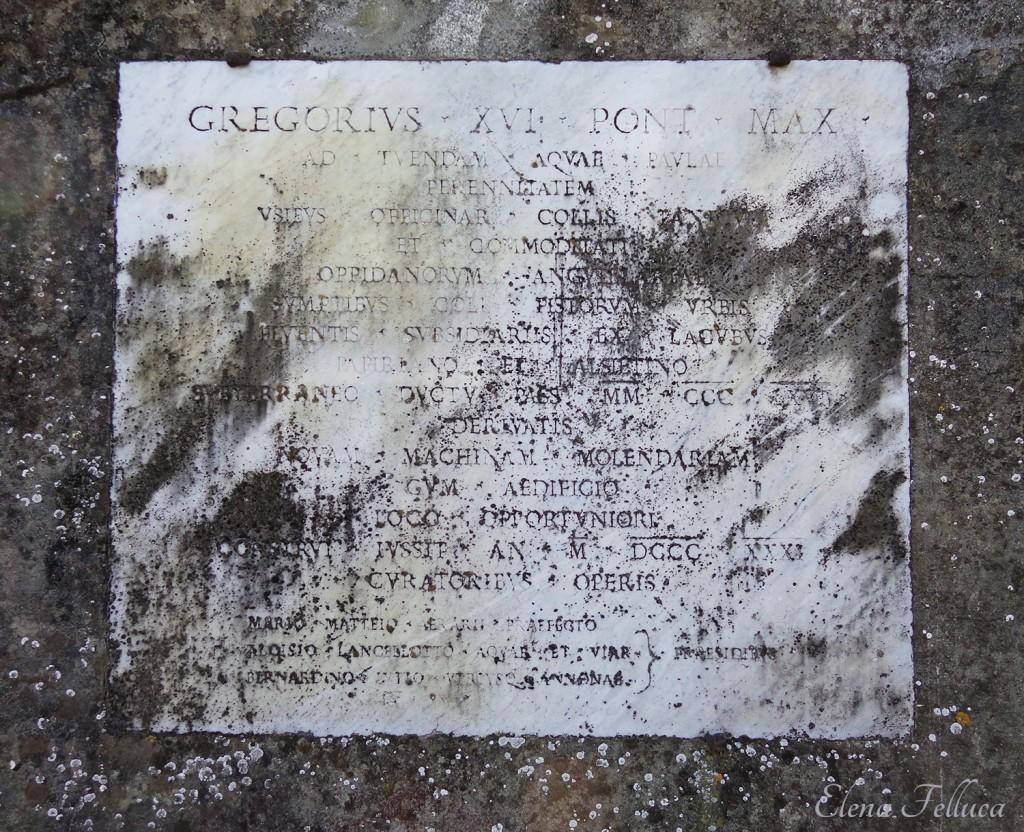
In 2 B.C., by order of Emperor Augustus, the Alsietino Aqueduct was constructed—a project that carried water from Lake Martignano over a distance of 33 km to the city of Rome. The unsanitary waters of the lake were rarely used for consumption and were primarily employed for irrigating farms. Very few records exist regarding the aqueduct's route; with the construction of the Trajan Aqueduct in 109 A.D., its function was superseded by the new system following a parallel course. Augustus' successors sought to augment the water supply of the Alsietino by drawing water from Lake Sabatino, and under Paul V this enhancement was implemented (hence the system's name, 'Acqua Paola'), with Galeria serving as the junction between the two aqueducts.
The small Lake Martignano, located about thirty kilometers from Rome, harbors an unusual secret: at a depth of around eight meters lie partially fossilized tree trunks, some still standing upright. Radiocarbon dating has confirmed that these trees are very ancient, dating back even to the Roman Imperial era
In the vicinity of the agriturismo, numerous historic villages dating from the medieval period can be found, some of which remarkably retain their original remains, much to the surprise of visitors. In some of these villages, the need of the former Papal States to erect fortresses or fortifications to defend their northern borders led to the construction of true defensive structures, while in others, the emphasis was sometimes on creating edifices designed for hunting or for the leisurely vacations of families of varying nobility.
It would be difficult to list them all here, so we will limit ourselves to the most significant ones, without intending to detract from those omitted:

